Daily Hypernovelty Lead · November 6, 2026
The Emergency Map Needs a Human Check
Indoor emergency planning still has a basic data problem: the satellite imagery, GPS, geographic information systems, and drones available outdoors do not follow responders through a building's walls.
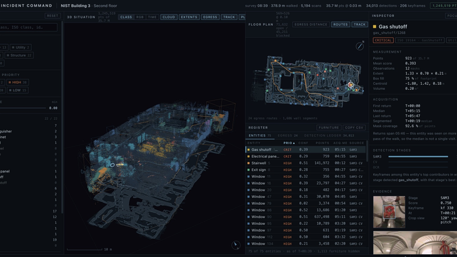
Indoor emergency planning still has a basic data problem: the satellite imagery, GPS, geographic information systems, and drones available outdoors do not follow responders through a building's walls. A NIST project article published November 5 describes a pipeline for turning interior scans into the structured spatial record that many departments cannot produce manually at scale.
The missing details can include standpipes, utility shutoffs, alarm panels, automated external defibrillators, ceiling heights, vertical connections, and clutter that affects whether a route is passable. Renovations can make the official drawing less useful still. A crew arriving at an unfamiliar building may therefore be working from an incomplete picture before anyone confronts the smoke, water, damaged walls, or limited visibility of the incident itself.
To reduce that gap, NIST's Public Safety Communications Research Innovation Lab, part of its Communications Technology Laboratory, is testing a pipeline called INSIGHT, short for Indoor Scene Intelligence from Geometric-Semantic Hierarchy Transfer. It turns three-dimensional building scans into structured indoor data intended to support pre-incident planning, navigation, scene documentation, and eventually incident command. NIST is clear about the present boundary: current work focuses on the pre-incident phase. Live tracking and command applications are future phases.
The harder cases are objects that ordinary indoor-mapping systems often miss. Exit signs, alarm panels, and AEDs are small, visually varied, and rare in existing training data. NIST says purpose-built 3D models scored near zero on these classes in a 2025 cross-dataset analysis. INSIGHT applies foundation models to recognize the features without task-specific training, then registered depth places them in three dimensions.
Verification bottleneck
A generated map can look complete while missing the one fixture or passage that matters. INSIGHT addresses that risk with separate detection paths that cross-check one another. Disagreement is flagged for human review. Building-code data provides boundaries for implausible results, and a person remains in the loop to verify the output before use.
That cross-check changes the reviewer's job. Automation processes the scan and proposes a structured map, leaving the reviewer to concentrate on disagreements, anomalies, and consequential objects instead of labeling the entire building manually. This preserves a clear acceptance point: the system can propose what is present and where it sits, while a responsible person decides whether the map is fit for the planning task.
Verification does not end at acceptance. Buildings change: renovations move walls, equipment is replaced, and storage can narrow corridors. A map that was accurate when captured can become misleading later. Any useful record therefore needs a date, a building version, a review history, and a route for recertification after material changes.
Once the record has been prepared, NIST says the information can reach responders within seconds over existing broadband. The project uses the public Point Cloud City dataset and open-source tools. Its outputs follow ISO 19164, IndoorGML, and IFC naming rather than a proprietary format, and the project describes source code and dataset documentation as part of the publication record. Role filters can provide different views for dispatch, incident command, and specialized responders.
Opportunities
The detection model creates a separate builder opportunity: a map-assurance workflow that manages initial capture, object-level review, change detection, recertification, role-specific views, and versioned receipts showing what was checked, by whom, and against which building state.
A second useful layer would connect renovation and inspection records to the map. A changed floor plan, relocated alarm panel, or new access restriction could automatically open a review task instead of waiting for the next emergency-planning cycle. Local departments and building owners could then see which areas remain current and which need another scan.
Open formats and published documentation can make that record easier to move between systems and preserve across procurement cycles, but they do not establish that a particular map is accurate. Accuracy still depends on the scan, the detection paths, the domain checks, the human reviewer, and the building remaining close enough to the state that was verified.
That boundary matters. INSIGHT is a NIST-tested pipeline described in a project article, rather than evidence of nationwide deployment or improved emergency outcomes. Its broader value is the operating pattern it makes visible: automation produces the first map, disagreement routes attention, domain constraints catch implausible results, and a human accepts the record before consequential use.